Maps
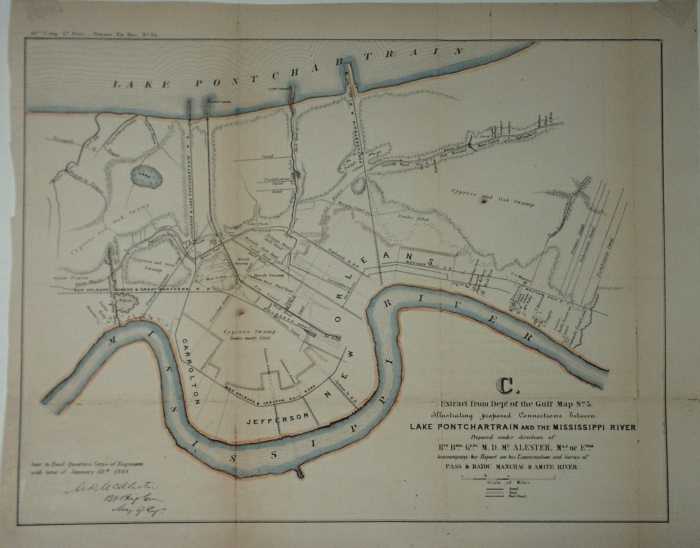
1913 Army Corps Of Engineers chart description
1868
Illustrating proposed connections between Lake Pontchartrain and the Mississippi River. Published Army Chief of Engineers Report 1868. Unfolded 13 3/4 x 10 1/2. Color added. It is a map from a report on examination and survey of Pass and Bayou Manchac and AMITE RIVER, with respect to rendering then navigable for First Class Steamboats.
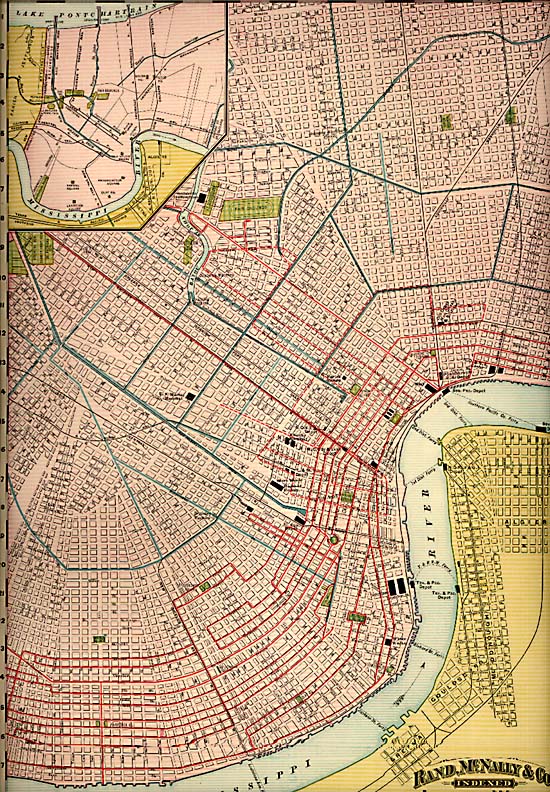
1892
22 x 15 Color 1892 Map of New Orleans. To the left of the title an example of the two red lines seen in the map which depict the location of the Electric Street Car Lines and the Mule Car lines. In the upper left an insert map depicting a section of the city along Lake Pontchartrain. A few of the interesting notations within the map include; all the Canal locations, Charity Hospital, Rail Road depots with rail company names, the Mint, Confederate Soldiers Home, location of the draining machines, Fair Grounds, US marine Hospital, Work house and the House of refuge to name a few
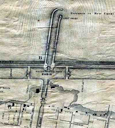
1873 - Plan plan for the redevelopment of the south shore
Source: http://nutrias.org/~nopl/exhibits/ccmem/10.htm This is a detail, showing the West End area, from a remarkable 1873 plan for the redevelopment of the south shore of Lake Pontchartrain in Orleans Parish. The larger plan provides us with several memories: the old, irregular shoreline prior to construction of the seawall, the Spanish Fort amusement park, and the Pontchartrain Railroad pier that allowed the 'Smoky Mary' to take its passengers all the way to the lake. Though never realized, this plan marked the beginning of the planning process that led to the Orleans Levee Board's 1920s reclamation project. [City Archives. Streets Department Records]
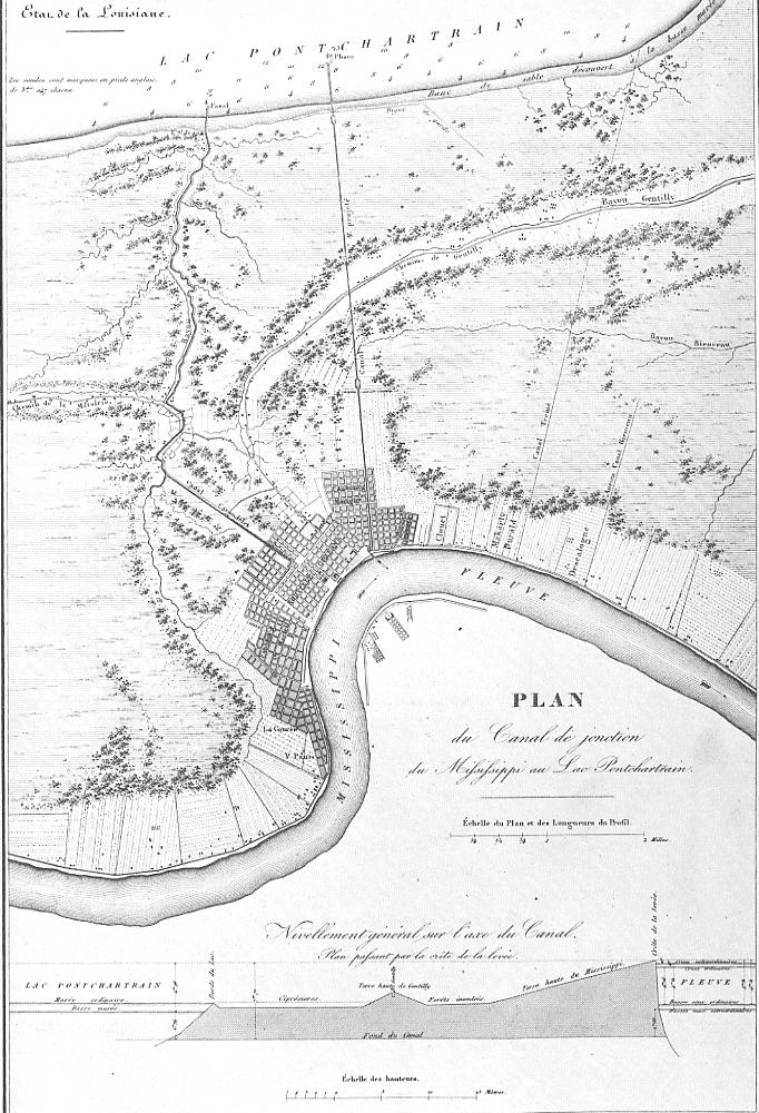
1828 - Plan for canal to connect the River to the Lake
Source: http://www.rootsweb.com/~usgenweb/maps/louisiana/citymap/neworleanscanal1828.jpg
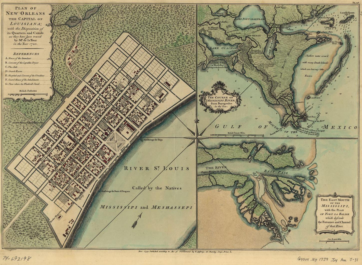
1759
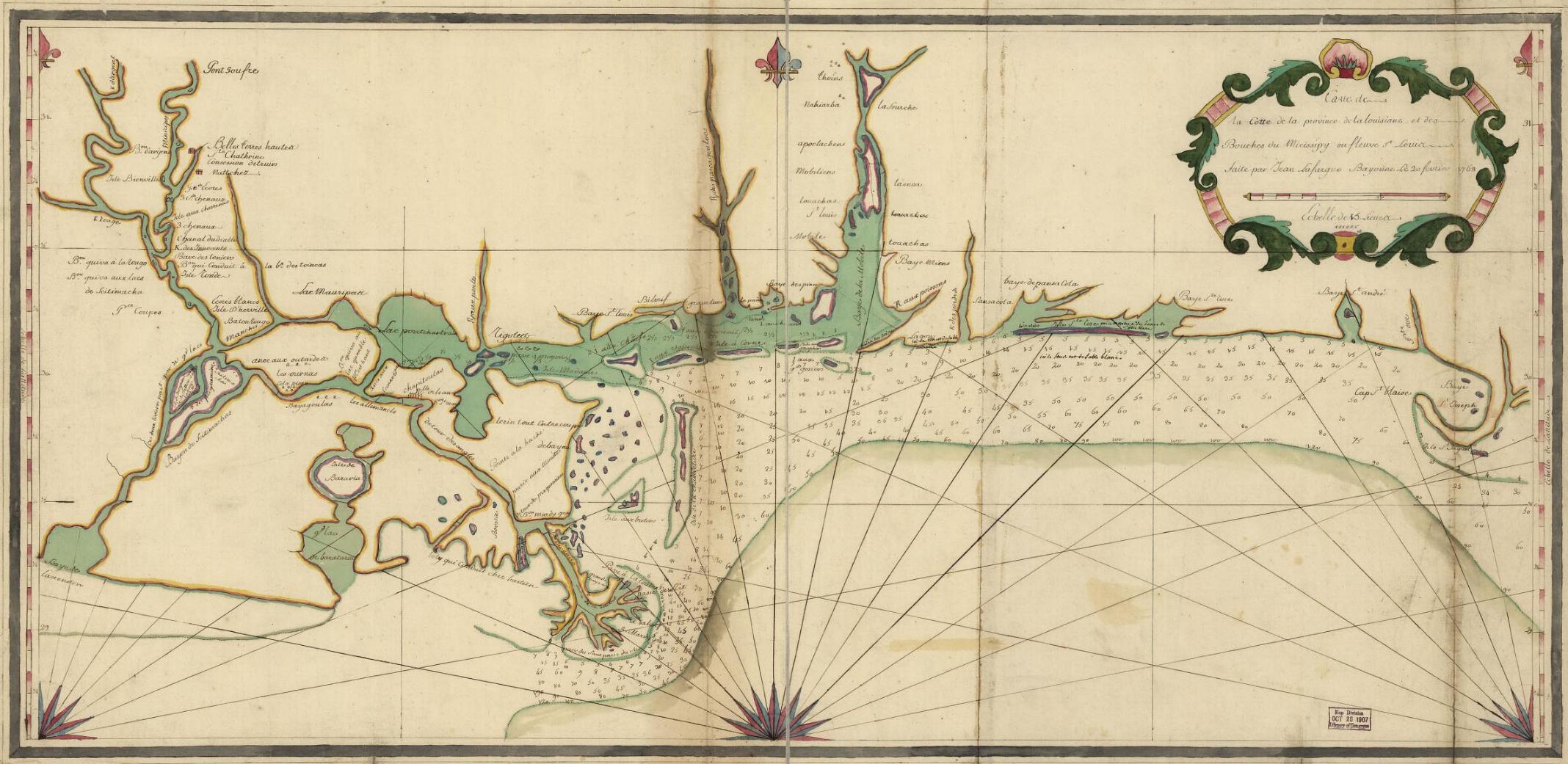
1768 map shows water route from the Lake to the River
Source: http://www.rootsweb.com/~usgenweb/maps/louisiana/statemap/lalms1768.jpg
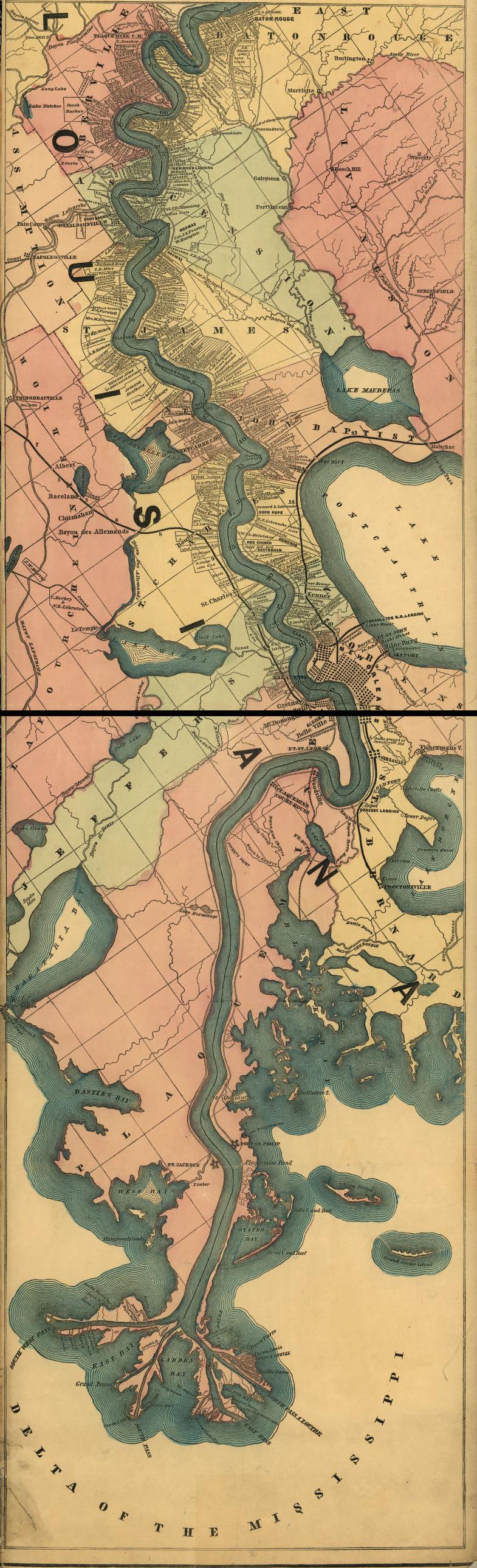
1862 shows Carrolton Railroad Landing, New Canal Light, Fort St. John Light, Milneburg, and Lakeport