The 1920s
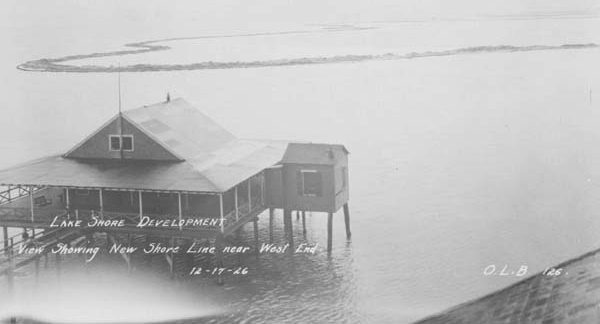
Hundreds of New Orleans lake front camps, from West End to Milneburg, were demolished during the 1920s and 1930s due to the massive land reclamation which created Lakeshore Drive and several subdivisions. The lakeshore, prior to land reclamation, was located at Robert E. Lee Boulvard.
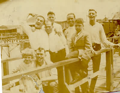
During the 1920's camps lined the entire New Orleans lakeshore.
But most of these where destroyed to make
way for the seawall, Lakeshore Drive, and new subdivisions. Along with the camps, during the late 20's we saw the end of the amusement parks, resorts, hotels, restaurants, dance halls, public piers, and 'honky tonks' which nurtured the birth of the blues and jazz in New Orleans.
At Milneburg
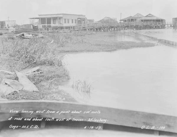
4/18/1927-was taken looking west from a point about 500 feet north of road and about 100 feet west of track at Milneburg.
Source: http://nutrias.org/photos/wpa/wpa24.htm
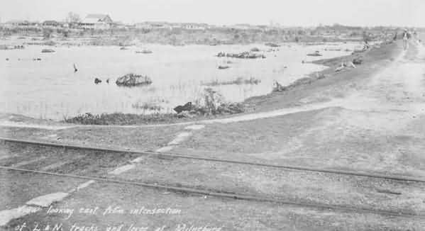
3/4/1927 -- was taken looking east from the intersection of the L&N railroad tracks and the levee at Milneburg.
Source: http://nutrias.org/photos/wpa/wpa24.htm
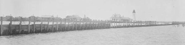
7/31/1928-showing the bulkhead of the seawall with the old Milneburg lighthouse in the background and camps to the left.
Source: http://nutrias.org/photos/wpa/wpa24.htm
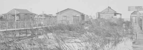
10/10/1923--was taken in front of the 'Bird Cage' cottage at Milneburg, looking toward the lake. See photo below for same view in 1941.
Source: http://nutrias.org/photos/wpa/wpa24.htm
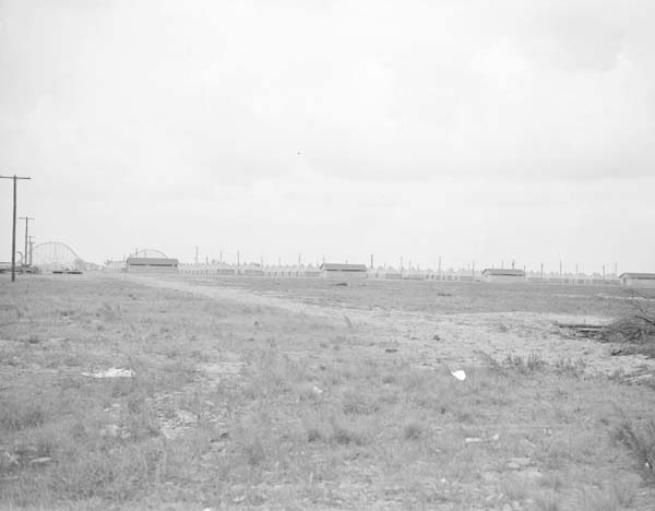
The after view shows the same area, then the site of the Army's recreation center and the Pontchartrain Beach amusement park.
Source: http://nutrias.org/photos/wpa/wpa24.htm
At Spanish
Fort
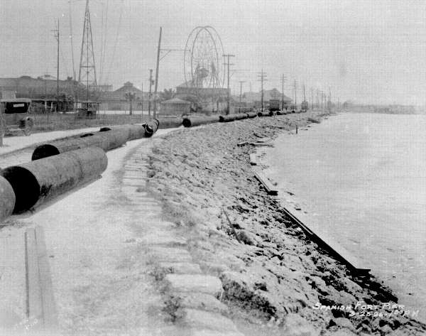
3/25/1926--shows the old amusement park at Spanish Fort in Zone II, looking south. Notice camps in the far right.
Source: http://nutrias.org/photos/wpa/wpa24.htm
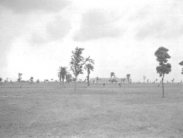
The after view shows the same area developed by the WPA and reclaimed by the Levee Board. The Southern Regional Research Laboratory can be seen in the background.
Source: http://nutrias.org/photos/wpa/wpa24.htm
At West End
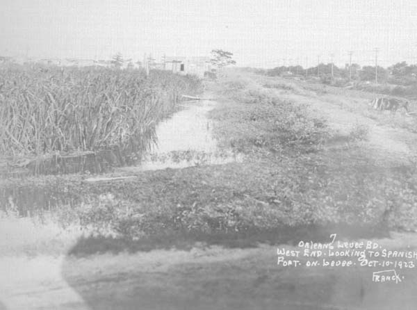
10/10/1923--shows the lakefront a West End looking toward Spanish Fort. Camps are in upper left quadrant of this photo. See below the same view in 1941.
Source: http://nutrias.org/photos/wpa/wpa24.htm
Source: http://nutrias.org/photos/wpa/wpa24.htm
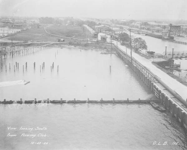
10/29/1926--looking south from the old rowing club at West End. Notice camps at the left. See photo below for same view in 1941.
Source: http://nutrias.org/photos/wpa/wpa24.htm
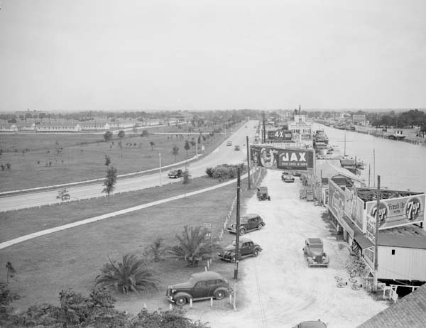
5/28/1941--same view as above shows the lakefront drive at West End, with the U.S. Army base hospital, LaGarde General Hospital, in the background.
Source: http://nutrias.org/photos/wpa/wpa24.htm
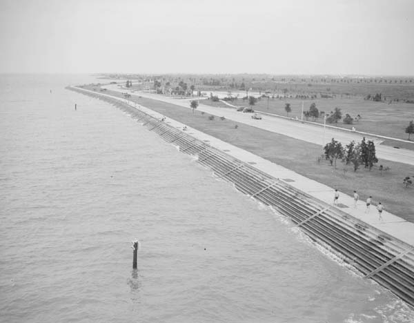
1941 view shows the new seawall and the network of drives paved by the WPA in a vast lakefront improvement program.
Source:
http://nutrias.org/photos/wpa/wpa24.htm